Artifical Intelligence in Mapping
Artifical Intelligence
Artificial Intelligence has revolutionized many industries, and architecture is no exception. In fact, some parts of this passage was generated by chatGPT, a trained model for conversation.
With the help of AI, architects and designers can now generate and visualize building designs in a fraction of the time it would have taken with traditional methods. One of the most promising applications of AI in architecture is the generation of images to guide design and building generation. By training AI algorithms on large datasets of architectural images and designs, researchers have been able to teach these algorithms to generate new images that capture the key features of different architectural styles, such as Gothic or Art Deco. These generated images can then be used to guide the design process, providing architects and designers with a source of inspiration and a starting point for their own creative ideas. In this way, AI is not replacing architects or designers, but rather empowering them to work more efficiently and effectively, pushing the boundaries of what is possible in architectural design and building generation.
Training AI through Dataset
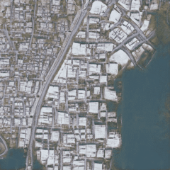
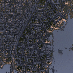
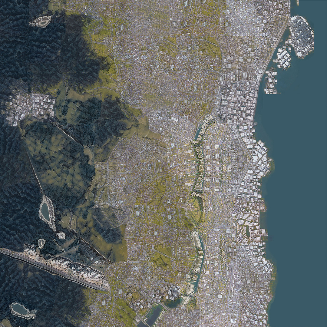
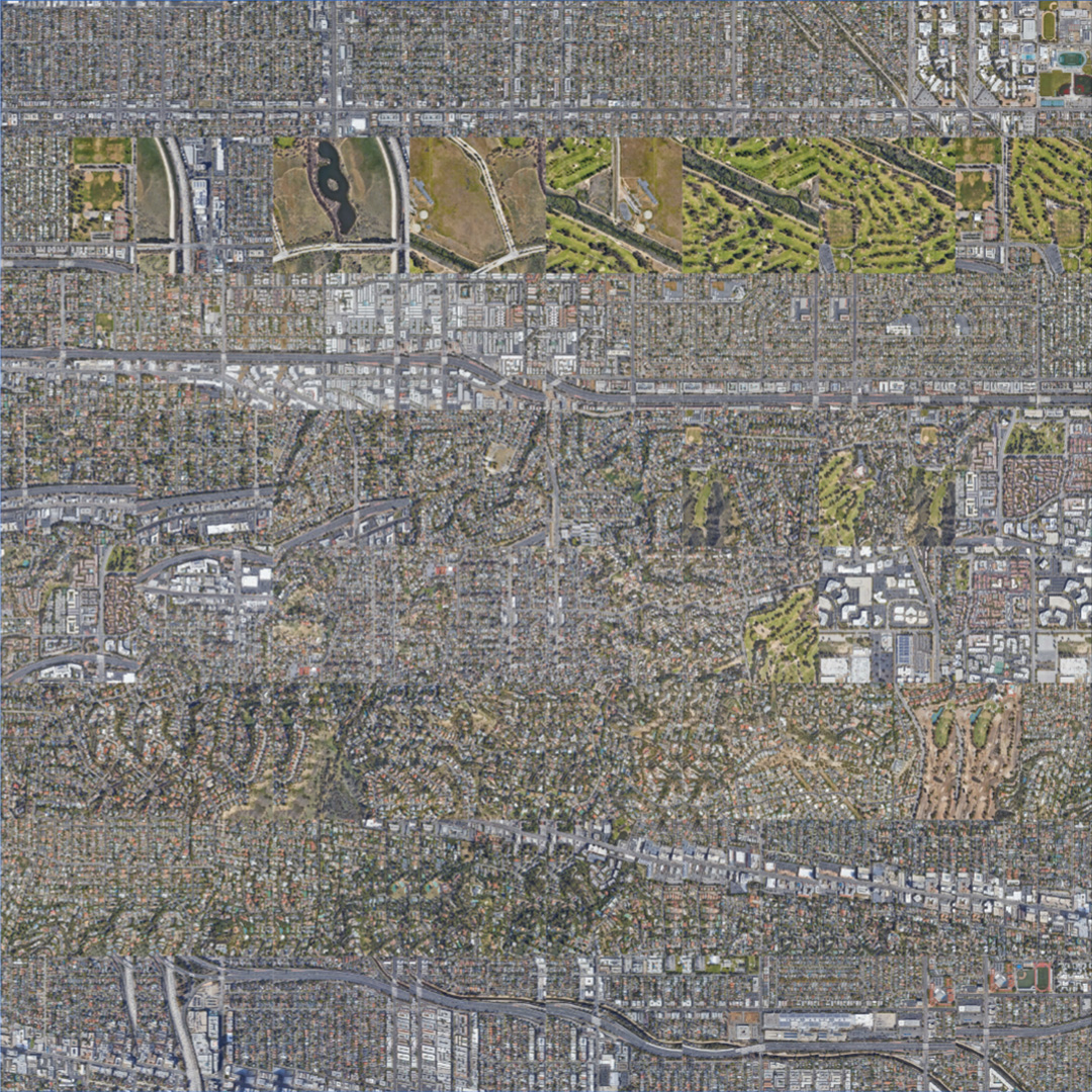
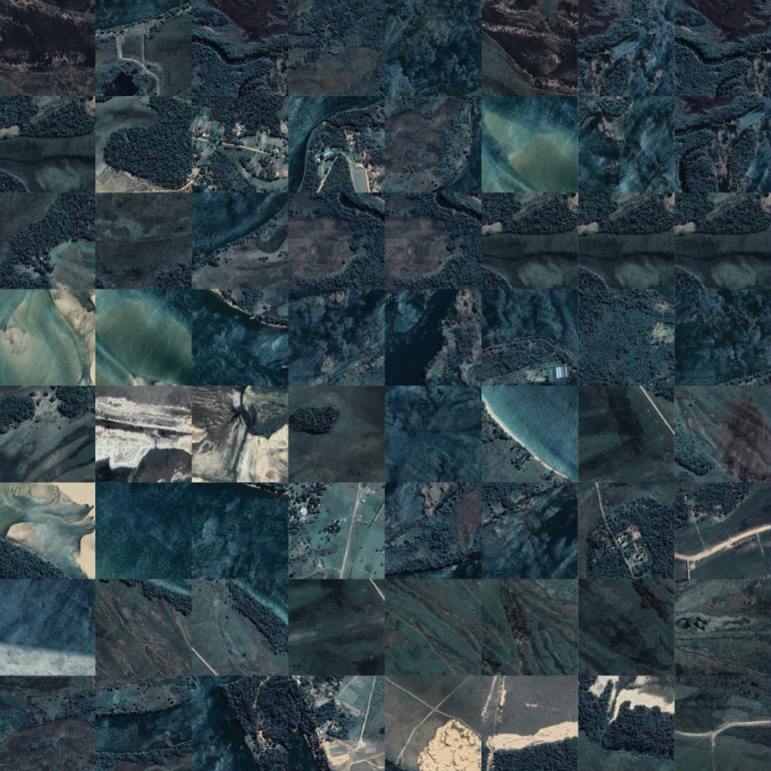
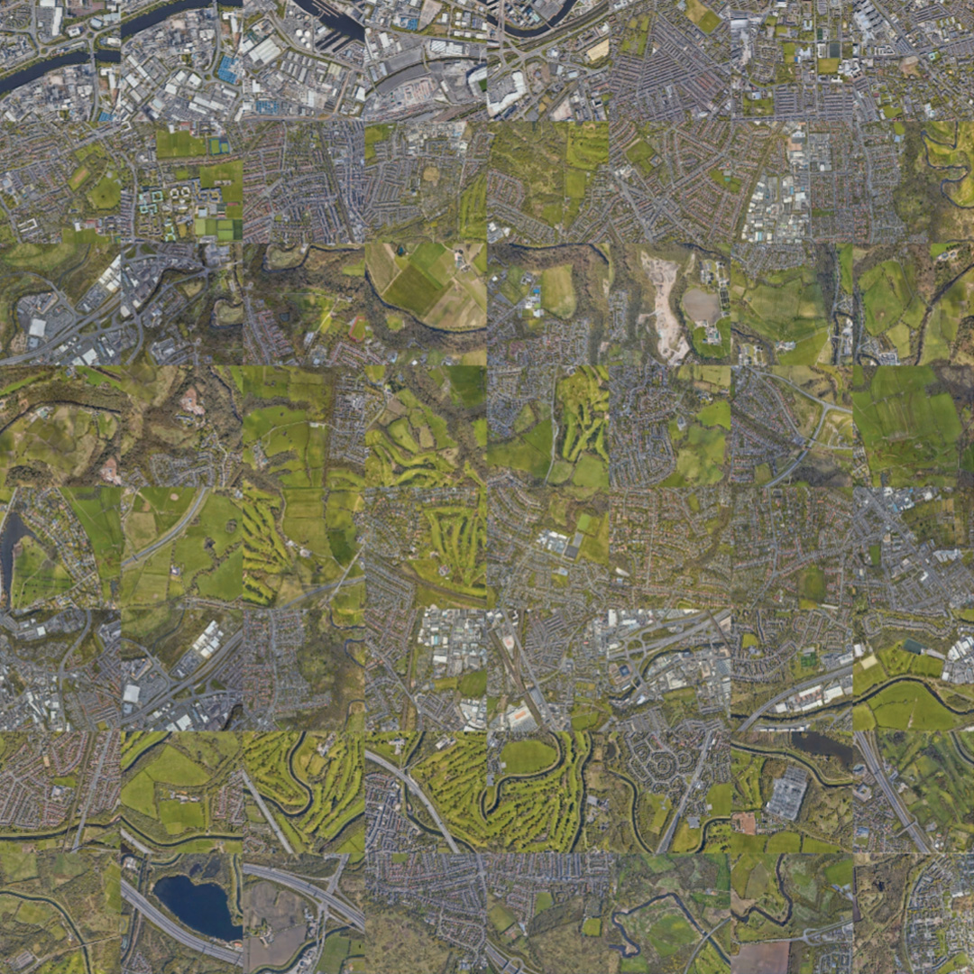
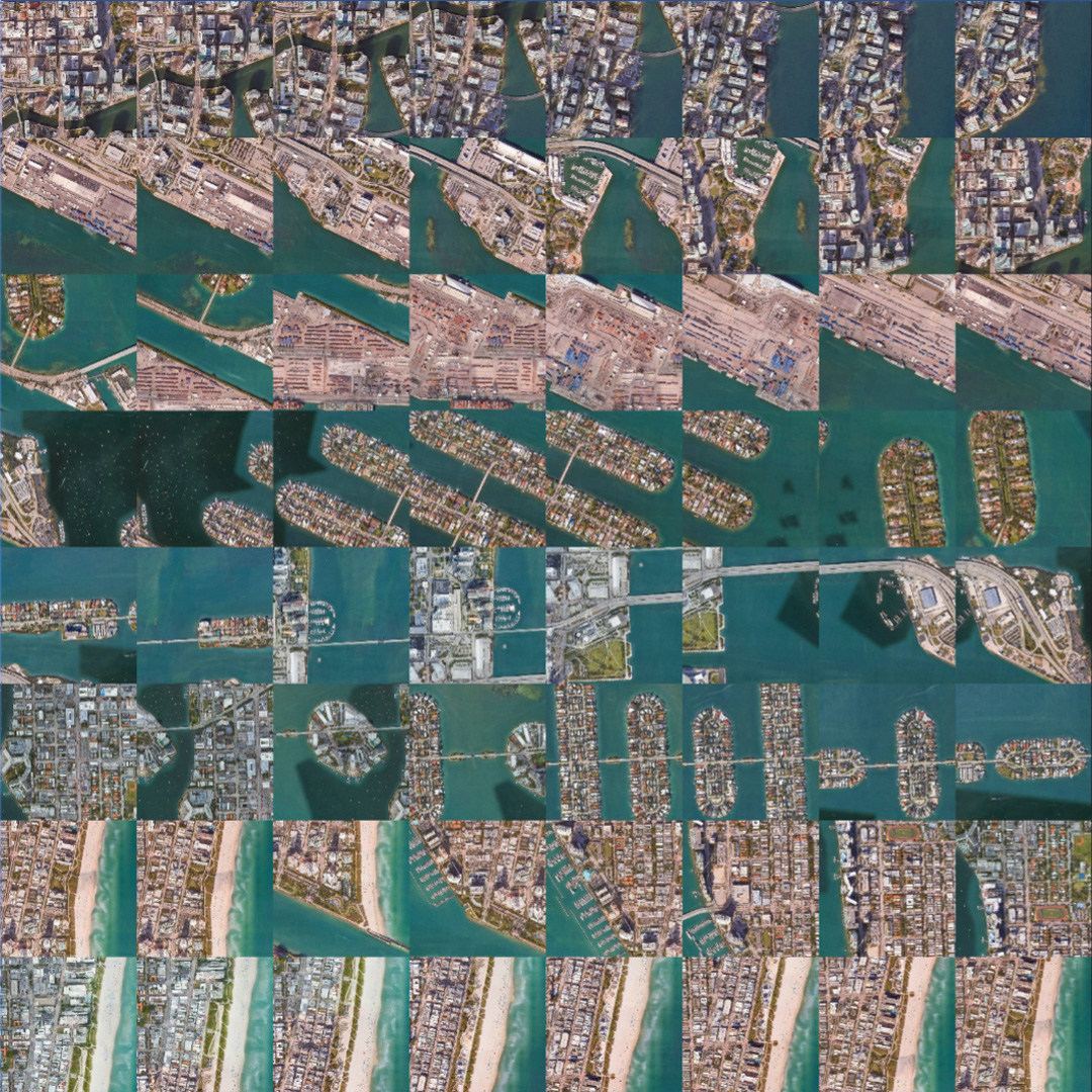
**Training an AI model **to generate accurate and detailed city maps requires high-quality training data that accurately represents the full range of urban environments. A diverse and representative training set can help the model learn to accurately identify the unique features and characteristics of different urban environments and generate reliable output results.
With the help of AI models trained on images of cities and villages, architects can now easily generate detailed city maps and 3D models that accurately capture the unique style of a given urban environment.
In our case, we use four different cities and villages as input sets to train our AI model. By using this diverse set of inputs, the model can learn to recognize common urban features and generate detailed maps that capture the unique characteristics of different urban environments. These maps can then be used as a model for creating new maps that accurately represent the characteristics of specific cities or regions.
However, it’s important to ensure that the training data is unbiased and complete, and accurately represents the full range of urban environments that the model will be expected to work with. Ongoing testing and evaluation can help identify areas where further improvements are needed, and ensure that the model is producing accurate and reliable results.
AI Images to Models

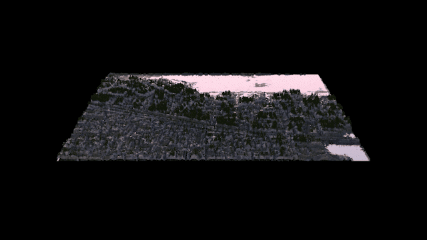
By using Cinema4D’s terrain generation plug-in, architects can quickly transform AI-generated images into realistic 3D models that can be used in a variety of ways. For example, architects can use these models to better understand and analyze the impact of proposed urban development projects on the surrounding environment. They can also use them to create stunning visualizations that help stakeholders better understand the design and layout of a proposed building or urban space. Overall, these tools can help architects work more efficiently and effectively, while also allowing them to create more detailed and accurate representations of the urban environments they are working with.
Artifical Intelligence in Mapping
https://xuanhe95.github.io/2023/03/30/Artifical-Intelligence-in-Mapping/